PORTFOLIO TIPS
|
The purpose of a GIS portfolio is to visually demonstrate that you are cabable of communicating complex geographic information in a professional way.
You can increase your changes of landing a new GIS job or internships if you have graphic examples of work you've completed in the past. Learn more on the Portfolio Tools page and by exploring the GIS Porfolio Tips Prezi. |
Tips for Success*Design your portfolio as a series of mini-advertisements featuring projects you've completed. Your goal is to spark conversations and interest in your work. You can provide more specific details about a project in your interview or include more details on a webpage you can link to.
*Demonstrate how you've solved a problem, improved a process, or answered a particular question using GIS. Communicate this information in your title. *Less is more. Try to limit the amount of text and graphics you include. Make sure to include captions with graphics explaining what the reader should take away from them. *Make sure to use vocabulary that "non-technical" readers will understand. The first person to view your portfolio within a company may be a human resources professional, administrative assistant, or other persona who isn't necessarily familiar with GIS terms such as "shapefiles" and "ortho-mosaics." *Along the same lines, avoid using acronyms such as "DEM." It's better to spell out the full words "Digital Elevation Model." |
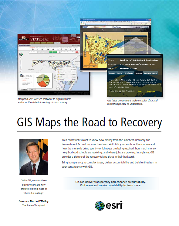 Notice how this advertisement from ESRI follows the Tips for Success. Click on the image to view a larger copy. |
